Most of western MN, including the STC area, is now under a Tornado Watch until 11 PM. This is where the Moderate Risk of Severe Storms is this evening. We are going to watch storms form within the next few hours out in the eastern Dakotas, western Minnesota and move northeast and eastward throughout the evening. Especially towards the beginning of the storms, when they are discreet cells, we could see large hail and some tornadoes. The SPC is not overly confident in tornadoes it looks like, only giving this watch box a 40% chance we could see at least two tornado touchdowns. These cells will likely merge into a line throughout the evening and continue their eastward path, and I think we have a better chance in the STC area of getting in on the line rather than discreet cells. At that time, the main threat will gradually turn to damaging winds with large hail, however we cannot rule out some quick tornadic spinups along the leading edge of the line. Stay alert as we go through the evening hours, and we’ll try to keep you updated, mainly on Twitter where you can find me @weathrlver. Keep reading for more information on the watch and the moderate threat.
Below is the tornado watch in effect until 11 PM for our area. The extreme southwest corner of Minnesota is also under a tornado watch until 9 PM tonight.

This is the categorical outlook from the SPC, as you can see the Moderate threat of severe storms stretches into the STC area. The main concerns in the STC area are isolated tornadoes and damaging winds. Image via.

Below is the HRRR (Rapid Refresh) model depiction of storms — first sparking as some discreet cells (maybe some tornadoes?) between about 7-8 PM, then moving into Stearns County around 10-11 PM as a vigorous line capable of damaging winds. This is off the 19z (3 PM) run. You can view more of that run by clicking here and viewing the Composite Reflectivity images. For reference, 00z is 7 PM.


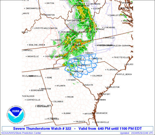
Below is a graphic of current warnings (updates every few minutes) from the SPC. You can view more on these warnings from the Chanhassen, Aberdeen, Sioux Falls, and Grand Forks offices by clicking on the links.

Below is the text of the 11 PM watch box. Some technical jargon, main things to take from it are that tornadoes are possible, along with hail up to 2.5″ and winds to 75 mph. Storms will move on average east to northeast at 40 knots (approximately 45 mph). You can also see the percentages of the threats that the SPC thinks will happen in the watch boxed area.
Tornadoes
| Probability of 2 or more tornadoes |
Mod (40%)
|
| Probability of 1 or more strong (F2-F5) tornadoes |
Low (20%)
|
Wind
| Probability of 10 or more severe wind events |
High (70%)
|
| Probability of 1 or more wind events > 65 knots |
Mod (40%)
|
Hail
| Probability of 10 or more severe hail events |
High (70%)
|
| Probability of 1 or more hailstones > 2 inches |
Mod (40%)
|
Combined Severe Hail/Wind
| Probability of 6 or more combined severe hail/wind events |
High (>95%)
|
URGENT – IMMEDIATE BROADCAST REQUESTED
TORNADO WATCH NUMBER 403
NWS STORM PREDICTION CENTER NORMAN OK
355 PM CDT MON MAY 30 2011
THE NWS STORM PREDICTION CENTER HAS ISSUED A
TORNADO WATCH FOR PORTIONS OF
WESTERN AND CENTRAL MINNESOTA
SOUTHEAST NORTH DAKOTA
NORTHEAST SOUTH DAKOTA
EFFECTIVE THIS MONDAY AFTERNOON AND EVENING FROM 355 PM UNTIL
1100 PM CDT.
TORNADOES…HAIL TO 2.5 INCHES IN DIAMETER…THUNDERSTORM WIND
GUSTS TO 75 MPH…AND DANGEROUS LIGHTNING ARE POSSIBLE IN THESE
AREAS.
THE TORNADO WATCH AREA IS APPROXIMATELY ALONG AND 90 STATUTE
MILES EAST AND WEST OF A LINE FROM 40 MILES EAST SOUTHEAST OF
WATERTOWN SOUTH DAKOTA TO 20 MILES WEST NORTHWEST OF BEMIDJI
MINNESOTA. FOR A COMPLETE DEPICTION OF THE WATCH SEE THE
ASSOCIATED WATCH OUTLINE UPDATE (WOUS64 KWNS WOU3).
REMEMBER…A TORNADO WATCH MEANS CONDITIONS ARE FAVORABLE FOR
TORNADOES AND SEVERE THUNDERSTORMS IN AND CLOSE TO THE WATCH
AREA. PERSONS IN THESE AREAS SHOULD BE ON THE LOOKOUT FOR
THREATENING WEATHER CONDITIONS AND LISTEN FOR LATER STATEMENTS
AND POSSIBLE WARNINGS.
OTHER WATCH INFORMATION…CONTINUE…WW 402…
DISCUSSION…SEVERE TSTMS ARE EXPECTED TO RAPIDLY DEVELOP LATE THIS
AFTERNOON/EARLY EVENING ACROSS EASTERN PORTIONS OF THE DAKOTAS INTO
WESTERN MN. IN THE WAKE OF A NORTHWARD MOVING WARM
FRONT…ADDITIONAL DESTABILIZATION WILL OCCUR OVER THE NEXT SEVERAL
HOURS…WITH A HIGHLY SHEARED ENVIRONMENT FAVORABLE FOR SUSTAINED
SEVERE TSTMS. INITIAL MODE SUPERCELLS CAPABLE OF LARGE
HAIL/TORNADOES CAN BE EXPECTED…WITH A QUASI-LINEAR EVOLUTION
LIKELY TO OCCUR LATER THIS EVENING INCLUDING A POTENTIALLY MORE
WIDESPREAD DAMAGING WIND AND ISOLATED TORNADO THREAT.
AVIATION…TORNADOES AND A FEW SEVERE THUNDERSTORMS WITH HAIL
SURFACE AND ALOFT TO 2.5 INCHES. EXTREME TURBULENCE AND SURFACE
WIND GUSTS TO 65 KNOTS. A FEW CUMULONIMBI WITH MAXIMUM TOPS TO
500. MEAN STORM MOTION VECTOR 22040.
…GUYER/HART