St. Cloud Area Weather

Highlighting important St. Cloud MN area weather events.

Monthly Archives: July 2010

Blog Hiatus: Wisdom Teeth

Ah, the joys of wisdom teeth. I am getting all four of my teeth extracted later today (Thursday), so for about the next week the blog may not be updated. I will do my best, especially with severe weather, but be advised that it may not happen. Here is to a speedy recovery!

SEVERE TSTORM WARNING FOR STC UNTIL 645… EXPECT HIGH WINDS SHORTLY IN STC

BULLETIN – IMMEDIATE BROADCAST REQUESTED
SEVERE THUNDERSTORM WARNING
NATIONAL WEATHER SERVICE TWIN CITIES/CHANHASSEN MN
600 PM CDT TUE JUL 27 2010

THE NATIONAL WEATHER SERVICE IN THE TWIN CITIES HAS ISSUED A

* SEVERE THUNDERSTORM WARNING FOR…
SOUTHERN MILLE LACS COUNTY IN EAST CENTRAL MINNESOTA…
EASTERN STEARNS COUNTY IN CENTRAL MINNESOTA…
NORTHWESTERN SHERBURNE COUNTY IN CENTRAL MINNESOTA…
BENTON COUNTY IN CENTRAL MINNESOTA…

* UNTIL 645 PM CDT

* AT 556 PM CDT…RADAR INDICATED A LINE OF SEVERE THUNDERSTORMS…
CAPABLE OF PRODUCING DAMAGING WINDS IN EXCESS OF 65 MPH. THESE
STORMS WERE LOCATED ALONG A LINE EXTENDING FROM RICE TO 3 MILES
SOUTHWEST OF COLLEGEVILLE TO PAYNESVILLE…AND MOVING EAST AT 45
MPH. PENNY SIZE HAIL MAY ALSO ACCOMPANY THESE DAMAGING WINDS.
A BRIEF TORNADO IS POSSIBLE ON THE LEADING EDGE OF THESE STORMS.

LOCATIONS IN THE WARNING INCLUDE…
ST CLOUD…
ST JOSEPH…
RICHMOND…
SARTELL…
COLD SPRING…
MAYHEW…
SAUK RAPIDS…
WAITE PARK…
GILMAN…
PLEASANT LAKE…
ST NICHOLAS…
PARENT…

PRECAUTIONARY/PREPAREDNESS ACTIONS…

IF YOU ARE IN THE PATH OF THIS STORM…PREPARE IMMEDIATELY FOR
DAMAGING WINDS IN EXCESS OF 60 MPH AND HAIL. SEEK SHELTER NOW INSIDE
A STURDY STRUCTURE AND STAY AWAY FROM WINDOWS.

SEVERE THUNDERSTORMS CAN PRODUCE TORNADOES WITH LITTLE OR NO ADVANCE
WARNING. PREPARE TO MOVE TO A PLACE OF SAFETY IN A STURDY STRUCTURE
SUCH AS A BASEMENT OR SMALL INTERIOR ROOM IF A TORNADO IS SPOTTED.

A TORNADO WATCH REMAINS IN EFFECT UNTIL 1100 PM CDT TUESDAY EVENING
FOR CENTRAL MINNESOTA AND NORTHWESTERN WISCONSIN.

SEVERE TSTORM WARNING TIL 615 FOR STC… 70 MPH WINDS EXPECTED!!!

BULLETIN – IMMEDIATE BROADCAST REQUESTED
SEVERE THUNDERSTORM WARNING
NATIONAL WEATHER SERVICE TWIN CITIES/CHANHASSEN MN
540 PM CDT TUE JUL 27 2010

THE NATIONAL WEATHER SERVICE IN THE TWIN CITIES HAS ISSUED A

* SEVERE THUNDERSTORM WARNING FOR…
STEARNS COUNTY IN CENTRAL MINNESOTA…
WESTERN BENTON COUNTY IN CENTRAL MINNESOTA…

* UNTIL 615 PM CDT

* AT 537 PM CDT…THE PUBLIC REPORTED A LINE OF SEVERE THUNDERSTORMS
WITH DESTRUCTIVE WINDS IN EXCESS OF 70 MPH. THESE STORMS WERE
LOCATED ALONG A LINE EXTENDING FROM 4 MILES NORTHWEST OF
HOLDINGFORD TO 3 MILES SOUTH OF NEW MUNICH TO 5 MILES SOUTHWEST OF
BELGRADE…AND MOVING EAST AT 35 MPH.  NICKEL SIZE HAIL MAY ALSO
ACCOMPANY THESE DAMAGING WINDS. SAUK CENTER REPORTED A 67 MPH WIND
GUST AT 527 PM.

LOCATIONS IN THE WARNING INCLUDE…
ST CLOUD…
GEORGEVILLE…
HOLDINGFORD…
ALBANY…
LAKE HENRY…
FARMING…
AVON…
RICE…
ST STEPHEN…
COLLEGEVILLE…
ROSCOE…
ST JOSEPH…

PRECAUTIONARY/PREPAREDNESS ACTIONS…

THIS IS A DANGEROUS SITUATION. IF YOU ARE IN THE PATH OF THIS
STORM…PREPARE IMMEDIATELY FOR DESTRUCTIVE WINDS…WHICH CAN UPROOT
TREES…DOWN POWER LINES…AND CAUSE DAMAGE TO ROOFS AND WINDOWS.
EVACUATE MOBILE HOMES AS THEY MAY BE OVERTURNED. HAIL IS ALSO
EXPECTED…WHICH CAN CAUSE MINOR DAMAGE TO VEHICLES AND WINDOWS. SEEK
SHELTER NOW INSIDE A STURDY STRUCTURE AND STAY AWAY FROM WINDOWS.

THIS STORM HAS A HISTORY OF PRODUCING DESTRUCTIVE WINDS AND LARGE
DAMAGING HAIL. SEEK SHELTER NOW INSIDE A STURDY STRUCTURE AND STAY
AWAY FROM WINDOWS!

A TORNADO WATCH REMAINS IN EFFECT UNTIL 1100 PM CDT TUESDAY EVENING
FOR CENTRAL MINNESOTA AND NORTHWESTERN WISCONSIN.

&&

LAT…LON 4577 9387 4559 9408 4541 9445 4540 9475
4542 9477 4542 9513 4578 9457
TIME…MOT…LOC 2239Z 268DEG 32KT 4576 9451 4558 9474
4541 9505
WIND…HAIL 70MPH 0.88IN

TORNADO WARNING FOR NORTHERN AND NORTH CENTRAL STEARNS COUNTY (INCLUDING ALBANY AND AVON)

BULLETIN – EAS ACTIVATION REQUESTED
TORNADO WARNING
NATIONAL WEATHER SERVICE TWIN CITIES/CHANHASSEN MN
516 PM CDT TUE JUL 27 2010

THE NATIONAL WEATHER SERVICE IN THE TWIN CITIES HAS ISSUED A

* TORNADO WARNING FOR…
SOUTHERN TODD COUNTY IN CENTRAL MINNESOTA…
EXTREME SOUTHWESTERN MORRISON COUNTY IN CENTRAL MINNESOTA…
EXTREME SOUTHEASTERN DOUGLAS COUNTY IN WEST CENTRAL MINNESOTA…
NORTHWESTERN STEARNS COUNTY IN CENTRAL MINNESOTA…

* UNTIL 600 PM CDT

* AT 512 PM CDT…RADAR INDICATED A STORM CAPABLE OF PRODUCING A
TORNADO. THE MOST DANGEROUS PART OF THE STORM WAS 3 MILES SOUTH OF
WEST UNION…OR ABOUT 6 MILES WEST OF SAUK CENTRE…AND MOVING EAST
AT 45 MPH.

* LOCATIONS IN THE WARNING INCLUDE…
SAUK CENTRE…
MELROSE…
GREY EAGLE…
GREY EALGE…
NORTH SHORE…
PLEASANT BEACH…
ST ROSA…
FREEPORT…
UPSALA…
ALBANY…
HOLDINGFORD…
AVON…

PRECAUTIONARY/PREPAREDNESS ACTIONS…

WHEN A TORNADO WARNING IS ISSUED BASED ON RADAR…IT MEANS THAT
STRONG ROTATION HAS BEEN DETECTED IN THE STORM. A TORNADO MAY ALREADY
BE ON THE GROUND…OR IS EXPECTED TO DEVELOP SHORTLY.

A TORNADO WATCH REMAINS IN EFFECT UNTIL 1100 PM CDT TUESDAY EVENING
FOR CENTRAL MINNESOTA AND NORTHWESTERN WISCONSIN.

Tornado Watch issued until 11 PM…

Tornado Watch has just been issued until 11 PM for the STC and Twin Cities metro area. SPC says a 70% chance of 2+ tornadoes… 30% of 1 being EF2 or higher. Continuing to watch for the latest…

Tornadoes

Probability of 2 or more tornadoes High (70%)
Probability of 1 or more strong (F2-F5) tornadoes Mod (30%)

Wind

Probability of 10 or more severe wind events High (80%)
Probability of 1 or more wind events > 65 knots Mod (40%)

Hail

Probability of 10 or more severe hail events High (70%)
Probability of 1 or more hailstones > 2 inches Mod (30%)

Combined Severe Hail/Wind

Probability of 6 or more combined severe hail/wind events High (>95%)

URGENT – IMMEDIATE BROADCAST REQUESTED
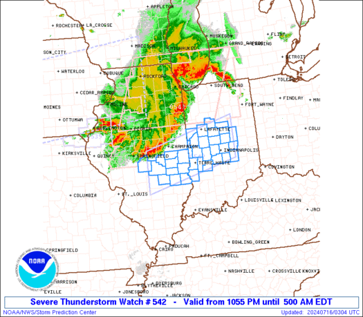
TORNADO WATCH NUMBER 542
NWS STORM PREDICTION CENTER NORMAN OK
330 PM CDT TUE JUL 27 2010

THE NWS STORM PREDICTION CENTER HAS ISSUED A
TORNADO WATCH FOR PORTIONS OF

LARGE PART OF NORTHERN AND CENTRAL MINNESOTA
PARTS OF NORTHWESTERN WISCONSIN
LAKE SUPERIOR

EFFECTIVE THIS TUESDAY AFTERNOON AND EVENING FROM 330 PM UNTIL
1100 PM CDT.

TORNADOES…HAIL TO 2.5 INCHES IN DIAMETER…THUNDERSTORM WIND
GUSTS TO 80 MPH…AND DANGEROUS LIGHTNING ARE POSSIBLE IN THESE
AREAS.

THE TORNADO WATCH AREA IS APPROXIMATELY ALONG AND 60 STATUTE
MILES NORTH AND SOUTH OF A LINE FROM 15 MILES NORTH OF ORTONVILLE
MINNESOTA TO 50 MILES SOUTHEAST OF KENNEDY WISCONSIN. FOR A
COMPLETE DEPICTION OF THE WATCH SEE THE ASSOCIATED WATCH OUTLINE
UPDATE (WOUS64 KWNS WOU2).

REMEMBER…A TORNADO WATCH MEANS CONDITIONS ARE FAVORABLE FOR
TORNADOES AND SEVERE THUNDERSTORMS IN AND CLOSE TO THE WATCH
AREA. PERSONS IN THESE AREAS SHOULD BE ON THE LOOKOUT FOR
THREATENING WEATHER CONDITIONS AND LISTEN FOR LATER STATEMENTS
AND POSSIBLE WARNINGS.

OTHER WATCH INFORMATION…CONTINUE…WW 541…

DISCUSSION…AIR MASS HAS BECOME VERY TO EXTREMELY UNSTABLE ACROSS
THE WATCH AS THE E/W WARM FRONT HAS SHIFTED NWD. WITH APPROACH OF
THE UPSTREAM TROUGH AND WIND MAX…THUNDERSTORMS EXPECTED TO DEVELOP
RAPIDLY VICINITY OF THE WARM FRONT AND MOVE EWD. SUPERCELLS
INCLUDING POSSIBLE TORNADOES ARE LIKELY ALONG WITH POTENTIAL FOR
VERY STRONG DAMAGING WINDS. THERE IS THE POTENTIAL FOR A STRONG
TORNADO OR TWO BY THIS EVENING.

AVIATION…TORNADOES AND A FEW SEVERE THUNDERSTORMS WITH HAIL
SURFACE AND ALOFT TO 2.5 INCHES. EXTREME TURBULENCE AND SURFACE
WIND GUSTS TO 70 KNOTS. A FEW CUMULONIMBI WITH MAXIMUM TOPS TO
650. MEAN STORM MOTION VECTOR 26035.

…HALES

SPC: Tornado Watch Likely Soon

SPC says a Tornado Watch is likely soon in an area from Little Falls to the Twin Cities north-southward and from the bulge in west central MN to western WI west-eastward.

MESOSCALE DISCUSSION 1476
NWS STORM PREDICTION CENTER NORMAN OK
0143 PM CDT TUE JUL 27 2010

AREAS AFFECTED…CENTRAL MN AND PART OF WRN/NWRN WI

CONCERNING…SEVERE POTENTIAL…TORNADO WATCH LIKELY

VALID 271843Z – 271915Z

TORNADO WATCH WILL BE COORDINATED SOON ACROSS MUCH OF CENTRAL MN
INTO PART OF WRN/NWRN WI.

EARLY AFTERNOON MESOANALYSES SHOWED A COLD FRONT ADVANCING EWD
ACROSS THE DAKOTAS INTO NWRN MN…WITH THIS FRONT INTERSECTING A
WNW-ESE ORIENTED WARM FRONT AND RETREATING OUTFLOW BOUNDARY OVER
SERN ND/ NERN SD. VISIBLE SATELLITE IMAGERY INDICATED HIGH LEVEL
CLOUDS ATTENDANT TO MORNING MCS HAVE DISSIPATED ACROSS CENTRAL MN
INTO WRN WI ALLOWING FOR STRONGER SURFACE HEATING WITH TEMPERATURES
CLIMBING THROUGH THE UPPER 80S TO AROUND 90 F FROM CENTRAL MN INTO
ERN SD. THIS COMBINED WITH RICH BOUNDARY LAYER MOISTURE /SURFACE
DEWPOINTS IN THE LOWER-MID 70S/ HAVE SUPPORTED MLCAPE UP TO
2500-3000 J/KG SO FAR.

SPECIAL 18Z MPX SOUNDING SHOWED WARMING HAS OCCURRED IN THE 850-500
MB LAYER…WITH ADDITIONAL SURFACE HEATING NEEDED TO WEAKEN THE
REMAINING SURFACE BASED INHIBITION. VISIBLE IMAGERY SHOWED CU
FORMING OVER FAR NERN SD IN THE VICINITY OF PERSISTENT LOW LEVEL
CONVERGENCE AT THE TRIPLE POINT/SUB-SYNOPTIC SURFACE LOW.
HOWEVER…INHIBITION IS STRONGER WITH WWD EXTENT PER OBJECTIVE
ANALYSES.

REGIONAL RADAR IMAGERY SHOWED NEW TSTMS DEVELOPING N OF THE WARM
FRONT IN SERN ND AS STRONGER FORCING FOR ASCENT WITH THE EWD MOVING
UPPER TROUGH AND ALONG THE COLD FRONT SPREAD INTO THIS REGION. THIS
ACTIVITY IS LIKELY ELEVATED AND MAY PRODUCE MAINLY A HAIL THREAT.
MEANWHILE…CONSECUTIVE RUNS OF THE WRF-HRRR SUGGEST SURFACE BASED
STORMS WILL DEVELOP BETWEEN 19-20Z OVER WEST CENTRAL MN. THIS
SCENARIO APPEARS LIKELY GIVEN ADDITIONAL SURFACE HEATING AND AN
INCREASE IN DEEP LAYER ASCENT SPREADING EWD INTO A REGION OF LOW
LEVEL CONVERGENCE ALONG THE WARM FRONT. GIVEN VERY STRONG
INSTABILITY EXTENDING EWD ACROSS CENTRAL MN INTO WRN WI AND
STRENGTHENING DEEP LAYER SHEAR…STORMS SHOULD QUICKLY BECOME SEVERE
ONCE THEY DEVELOP INTO CENTRAL MN. S/SELY SURFACE WINDS BENEATH A
STRENGTHENING SWLY LLJ WILL SUPPORT AN INCREASE IN HODOGRAPH
CURVATURE AND AN INCREASED POTENTIAL FOR TORNADOES.

..PETERS.. 07/27/2010

Severe Threat Today, Along With Other Tidbits

We are once again under a Slight Risk of Severe Storms over the area today. The main threat for the area will be large hail and damaging winds, although we are under a 5% chance of tornadoes — and from the Twin Cities eastward they are under a 10% hatched risk. General thinking is that the storms will start popping along the cold front later today (well, duh). My thought is them reaching the STC area 4-7 PM if not later, and after 6 PM for the Twin Cities area. Heavy rain will also be possible, with totals over 1″ in areas. Will continue to monitor the threat and update as needed. Paul Douglas will also be attempting to run a live stream of severe weather coverage later today on the Star Tribune website — I’ll get you that link when I can.

Meanwhile, I was once again on blog duty this morning. Enjoy the Ham Weather Biosphere Blog post — which I invite you to also go read at the link provided too!

Read more of this post

Nice Today, Severe Possible Tuesday — Along with Bonnie, Iowa Flooding, Heat along the coasts, and Meteor Showers

Want some nice weather? Well, I’ve got some for you the next two days. It’ll be mainly sunny today with highs in the lower 80s with low humidity and winds. It’ll stay mostly sunny tomorrow with highs in the mid 80s, but expect a return of some more humid air as a southerly wind at around 10 mph kicks into gear ahead of our next system.

A cold front will come sweeping through the area Tuesday and Tuesday Night, bringing with it some more stormy weather for the area. We are currently under a Day 3 Slight Risk of Severe Storms… it looks like there will be the chance of all three main severe weather possibilities (wind, hail, tornado) to be in effect for the afternoon and evening. We’ll keep an eye on it and let you know the latest as the event creeps closer. Highs Tuesday will be near 90.

Temps will cool back into the low to mid 80s for the rest of the week with some sunny skies. We will have to keep a scattered storm chance mainly at night for the last few days to end the work week but I don’t expect them to be much of a concern at the moment.

Meanwhile, I tackled many other topics this morning in the Ham Weather blog, including the remnants of Bonnie, a dam eroding away due to rain in Iowa, heat along both coasts, today’s severe weather threat for the nation, and a few upcoming meteor showers that you can view. You can, of course, go and view the post on the Ham Weather Biosphere blog, or view it below as well.

Read more of this post

Chautauqua Lake NY Tornado Video

This is video of a tornado around Chautauqa Lake, NY, yesterday. Of course, these type of events are beautiful to witness to the meteorologist, and to the ones that get to view video of it, but scary for those actually witnessing and being a part of the event — especially in the New York area, which typically people don’t associate with tornadoes.

Weekend Weather… and Reasoning with TD Bonnie

As I write tonight’s forecast, I hear rolling thunder in the background, some of which is seeming to last 30 seconds on end. That is the story for tonight — showers and thunderstorms moving through the area, though not as strong as the storms down south. A Severe Thunderstorm Watch is in effect for parts of southern MN, south of the Twin Cities, until 7 AM as a bowing line of storms, capable of 60-70 mph winds, blows across the area. Up here we will see general showers/storms in the next few hours before the system should move eastward. Storms may put down some heavy amounts of rain. Lows tonight will be around 62.

We could see some lingering rain in the morning hours, before the skies try to clear throughout the midday and afternoon hours. Highs will be around 78. We might see some gusty winds in the wake of this system, so watch out if you are heading out to the lake for winds up to 20 mph or so.

Sunday we should see mainly clear skies with low wind and low humidity with highs getting into the lower 80s. This weekend, besides the early rain on Saturday… looks like a picture perfect weekend, one which we haven’t seen in a while.

We will be on the lookout for more storms next week… the best chances being Tuesday through Thursday. Highs for most of next week should be in the low to mid 80s.

Bonnie Looks Weak Over The Ocean…

Bonnie was downgraded to a Tropical Depression earlier today after making landfall in Miami-Dade County this morning near the same location Hurricane Andrew made landfall in 1992 — but a totally different storm than that one was. Bonnie is a very disorganized system right now and, while expected to organized and strengthen a little, remain very weak. Current forecasts have it expected to be a weak tropical storm, with winds of 40 mph, when it makes landfall in Louisiana near New Orleans on Sunday. BUT this storm remains so disorganized at this time that it is entirely possible, and possibly quite likely, that Bonnie will fall apart during the day Saturday and not be much of anything but a rain maker as it approaches the coast.


NHC Path with satellite and radar overlay as of 12 AM Saturday. Map thanks to Ham Weather — a division of WeatherNation